The short answer
Choose by the measurement. A single-beam echosounder such as Ping2 gives one number, the range to the nearest echo inside its 25° beam: use it for depth logging from a boat and for altitude hold on an ROV. A scanning imaging sonar such as Ping360 turns a narrow beam through a circle and draws what is around the vehicle: use it to navigate and search where a camera sees nothing. Many vehicles carry one of each.
- A 25° beam lights a circle about 0.44 × the range across; a 2° beam, about 0.035 × the range.
- Each ping waits for its echo: about 0.07 s for sound to go 50 m and back.
- A range reading is only as good as the speed of sound it assumes.
Sonar answers two different questions, and buying the wrong kind is the usual mistake. One kind tells you how far away the bottom or a wall is. The other shows you a picture of what is around the vehicle. Start from which question you need answered.
What each kind measures
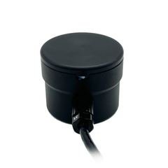
A single-beam echosounder sends one short pulse down a fixed cone and times the echo. It reports a distance: to the bottom when it points down, to a wall when it points forward. Blue Robotics' Ping2 is this kind. Blue Robotics gives it a 115 kHz pulse, a 25° beam, a range of up to 100 m and a 300 m depth rating, running from a 4.5 to 5.5 V supply.
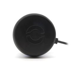
A scanning imaging sonar sends pulses down a narrow fan and turns it, step by step, through a full circle or a sector you choose. It builds an image of echo strength around the vehicle: walls, pilings, the seabed, a lost object. Blue Robotics' Ping360 is this kind: 750 kHz, a beam 2° wide and 25° tall, a range of up to 50 m and a 300 m depth rating, from an 11 to 25 V supply over USB, RS485 or Ethernet.
Neither is a camera. Sonar sees in water too murky for any light, but it shows echo strength, not colour or detail, and reading its images takes practice.
Choose by the job
| What you need | Use | Why |
|---|---|---|
| A depth map of a lake or harbour from a boat | Echosounder, pointing down | Every reading is a depth, logged against GPS position |
| Altitude hold on an ROV or AUV | Echosounder, pointing down | The autopilot needs one distance, updated often |
| Distance to a wall or hull ahead | Echosounder, pointing forward | One distance is all the pilot or the code needs |
| Finding your way in zero visibility | Scanning sonar | The pilot needs to see what is around, not one number |
| Searching for an object on the bottom | Scanning sonar | It shows shapes and shadows across a wide area |
| Inspecting a pier, dam face or hull | Scanning sonar, with a camera | The sonar finds it; the camera shows it once close |
ArduPilot supports the Ping echosounder as a rangefinder, so the reading goes straight into altitude hold on ArduSub or into the log on a Rover boat. A scanning sonar's image goes to the pilot's screen in Blue Robotics' software, or to your own code if the vehicle is to use it.
The beam decides what you can resolve
A beam spreads as it travels, and anything inside it returns an echo. The width of the circle or strip it lights at a range R is 2 × R × tan(beam ÷ 2).
- Ping2, 25° beam. 2 × tan 12.5° = 0.44, so the footprint is about 0.44 × the range across. At 10 m it lights a circle about 4.4 m wide, and it reports the nearest thing inside it. Over a sloping or rocky bottom that is the shallowest point in the circle, not the point straight below. For a survey, that sets how fine the map can be.
- Ping360, 2° horizontal beam. 2 × tan 1° = 0.035, so at 20 m the beam is about 0.7 m wide. Two objects closer together than that, at that range, merge into one blob. At 5 m the beam is under 0.2 m wide and the picture is much sharper. Its 25° vertical spread means it also picks up the bottom and the surface when the water is shallow.
A scan takes time
Each ping has to wait for its echo to come back from the edge of the range before the next one goes out. Sound travels at about 1,500 m/s in water, so a ping set to 50 m waits about 100 m ÷ 1,500 m/s = 0.07 s. A full circle needs one ping for every step the head turns, and with a 2° beam that is at least 180 pings. At 50 m range a full circle therefore takes on the order of ten seconds or more.
That is fine for mapping a harbour wall and slow for avoiding an obstacle at speed. Shorten the range, or scan only the sector ahead, and the picture updates much faster. The same arithmetic limits an echosounder, but it pings along one line only, so it updates many times a second at typical ranges.
Speed of sound, and why it matters
Sonar measures time and converts it to distance at an assumed speed of sound. In fresh water that speed rises from about 1,480 m/s at 20 °C to about 1,510 m/s at 30 °C, a 2% change; sea water is faster again and varies with temperature and salinity. Set the speed of sound for your water in the sonar's software, or log the water temperature and correct the ranges afterwards. Our survey boat guide shows the correction.
Mounting and wiring
- Echosounder. Point it straight down, below the waterline, clear of the hull and away from the thrusters' wash, because bubbles hide the bottom. On a BlueBoat, Blue Robotics sells a Ping2 integration kit.
- Scanning sonar. Give it a clear view all round: on top of an ROV to look forward and to the sides, or below it to look at the bottom. Keep it away from the frame, which returns strong echoes of its own, and from the thrusters.
- Cables. Each sonar's cable enters a housing through a penetrator matched to its diameter, and the Ping360 needs a data link to the surface for its image. See our guide to penetrators and connectors.
If you need more than these
Both sonars here are for small vehicles. Survey-grade multibeam echosounders, side-scan sonar and Doppler velocity logs are a different class of instrument and budget. Tell us the task, the depth and the vehicle, and we will say whether one of these covers it.
Both sonars are listed with prices on our underwater sonar page.
Sources.
- Ping360 frequency, beam width, range, depth rating, supply and interfaces from Blue Robotics' Ping360 product page and its launch announcement (accessed 2026-09-26)
- Ping2 frequency, beam width, range, depth rating and supply from Blue Robotics' Ping sonar technical guide (accessed 2026-09-26)
- ArduPilot rangefinder support from ArduPilot: Blue Robotics Ping sonar (accessed 2026-09-26)
- Speed of sound in water from standard tables. Beam footprints and scan times are worked from the published beam widths and ranges; treat them as estimates and check the manufacturer's documentation for the scan rates your settings give.
Published 26 September 2026. Corrections to sales@vebixautomation.com.
Choosing sonar for a project?
Send us the task, the water depth and the vehicle. We will check which sonar suits it and send a quotation your institution can raise a purchase order against. Ask for a quote.
Compare the parts: Underwater sonar: echosounders and scanning imaging sonar
More on underwater robotics
- Underwater and ROV thrusters in IndiaBlu-Sub and Blue Robotics underwater thrusters for ROVs, AUVs and USVs, with prices in rupees and delivery across India included.
- How to choose an underwater thruster for an ROVHow to choose an underwater thruster for an ROV by thrust, voltage, depth rating, ESC, rotation and mounting.
- How to size an underwater thruster for an ROVSize ROV thrusters from drag, target speed and vectoring angle. Worked method for thrust per unit, thruster count and the margin real vehicles need.
- Designing a 300-metre ROV propulsion systemPropulsion design for a 300-metre ROV: thruster count and layout, bus voltage, tether losses, sealing and the effect on buoyancy.
- Aluminium versus acrylic subsea enclosuresAluminium and cast acrylic subsea housings compared on depth rating, optical access, heat, servicing and cost.
- Selecting a subsea enclosure for marine research payloadsHow to choose a subsea enclosure, end caps, seals and penetrators for research payloads, and how to test them before fieldwork.